|
|

| Tue., June 9, 2026 |
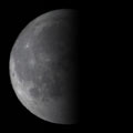 |
| Moon Phase: Last Quarter |
|
Next Full: June 29 Next New: June 14 Sunrise: 5:25 a.m. Sunset: 8:25 p.m. |
| More Info |
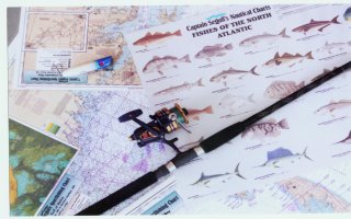
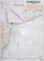
| Captain Segull's Nautical Charts | |||
Captain Segull’s Nautical Charts are designed for the serious sport fisherman. |
|||
|
The charts include fishing holes with local names, reefs, wrecks and buoys. They include GPS latitude and longitude, Loran TD’s on offshore charts, contour lines and shore services such as fuel docks, loading ramps, pump-out stations and restaurants.
|
||
On a personal note, these products offer some of the best detail we’ve ever seen, with more wrecks and structure than are normally included on other charts, and with the highest quality stock and laminate, standing up to the roughest, soggiest boating conditions for anglers. |
|||